2012: Longhouses, Trenches, & More!

In 2012, the team continued excavations, geophysical prospecting, and systematic surface collecting to learn more about how environmental, ecological, and social forces worked together to influence the development of the tell and its surrounding settlement.
Longhouse & Tell Excavations
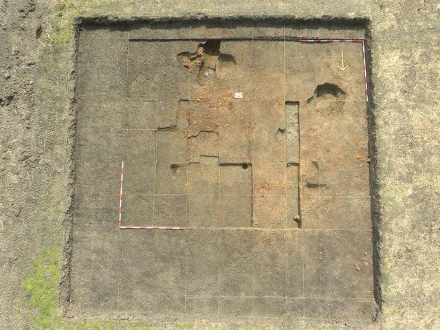
The team team began to get a glimpse of the kinds of activities that occurred inside the site's longhouses by placing new excavation units on three different longhouses—in the north (N1B1), southeast (SE1B1), and west (W1B1).
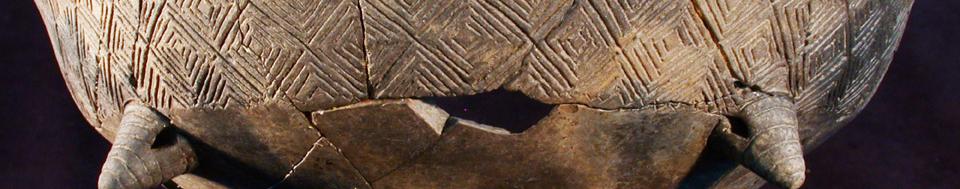
- N1B1 contains the largest longhouse yet discovered. Located on the northern end of the site, it measures about 23 x 7 meters (about 75.5 x 23 ft) and is oriented NW-SE, as are most of the other longhouses. The N1B1 structure has been well preserved by a thick layer of burnt wall rubble (daub), likely a result of the house having been purposefully burned and abandoned. To the team's surprise, once the top daub layer was removed, they identified the impressions of several wood planks that had been pushed into the clay floor under the house.
- SE1B1 also contained a concentration of daub, but mixed with thick black clay, which likely means the area was wet while the daub layer was forming. This made it very difficult to identify different layers within and below the daub, and nearly impossible to identify features like postholes or wall trenches. Despite heroic efforts to tease out details from the excavation site, the team was unable to identify the exact structural organization of the longhouse.
-
W1B1 contained pits, postholes, and possible wall trenches—features that can be used to help the team digitally reconstruct the longhouse to learn how it was built and used over time. (Longhouses typically housed families or were used for rituals.)
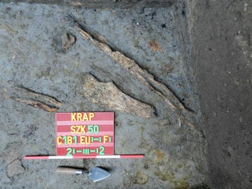
In 2012, the team also successfully located one of the original trenches dug by the Hungarian archaeologist Kornél Bakay when he explored the site in the late 1960s. At the bottom of the trench, the team found many artifacts and ancient wooden timbers as described in Bakay's notes. And beneath these 7,000-year-old timbers, the team discovered cultural layers that run even deeper and extend further back in time. By exposing the profiles of this trench, the team revealed a “slice of time” that shows how the tell evolved throughout history.
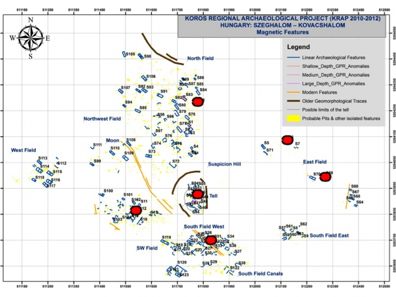
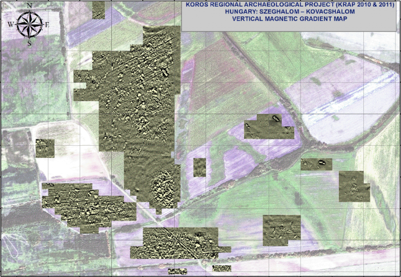
Geophysical Prospection & Soil Sampling
The team also continued to use magnetometers and ground-penetrating radar to locate ancient features hidden beneath the soil. A new, experimental technique called electrical resistivity tomography (ERT) worked extremely well for identifying the depths and extents of cultural and natural features of the site. The paleo-environmental reconstruction team will use this information, as well as the data collected through sediment cores (which contain pollen grains and other clues to the ancient environment), to build a model of how the landscape changed throughout the millenia.
Artifact Sampling
Although the team had already gridded and collected at all of the “surface hotspots” (areas where concentrations of artifacts lie exposed on the ground), this year the team finished filling in the gaps between these hotspots. This entailed the collection of a lot of “negative data”—evidence that specific activities didn’t happen in particular areas. In other words, to say for certain that people once conducted specific activities in precise locations, the team had to demonstrate for certain exactly where those same activities weren’t conducted!
2012 Final Results
After processing the data from their excavations, geophysical prospection, and soil and artifact sampling, the team has concluded that all the longhouses were built and destroyed during the later phase of the settlement—sometime around 4,800 B.C. The tell, however, was occupied for quite some time—since the end of the Middle Neolithic period, during the later sixth millennium B.C.
There also are some traces of activities that suggest people were around the site during that earlier period, but the team found nothing like the explosion in settlement that occurred during the beginning of the fifth millennium B.C. Future expeditions to the site will help provide an even clearer understanding of how the settlement grew and expanded over time.