2. Surprising Findings in the Field
Submitted by William Parkinson on Thu, 04/01/2010 - 10:12
© Dr. Paul Duffy
Map of Tell Site
“A szeghalmi járás nagyon érdekes őskori terület...”
Translation: “The Szeghalom parish is a very interesting prehistoric region...”
Kálmán Darnay, "Szeghalmi Ásatásról," Archaeologiai Értesitő, 1905, p. 66
Boy is that an understatement! I now know first-hand what the archaeologist Kálmán Darnay experienced more than a hundred years ago, when he began the first excavations at the Szeghalom-Kovácshalom tell, the site where we’re currently working.
When I wrote my last dispatch, we were just getting under way. We're now approaching the end of our second full week in the field, and we've already accomplished a lot! Although we had some snow when we first arrived, since then the weather has cooperated and (knock on wood), we've not yet had a rain day.
To take advantage of the weather, we've been working very long days: breakfast at 6:30 a.m., in the field until 2:00 p.m., late lunch, then labwork processing the finds until dinner at 7:30 p.m. Most nights we also continue working after dinner until late in the evening.
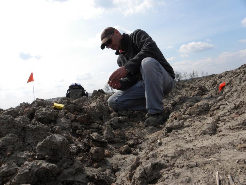
The team arrived on Wednesday, March 17, and we had them working in the field the following morning. We used the GPS to stake out a 10x10-m grid over the tell site, and then we began collecting the materials on the surface inside each one of the grid squares (see Photo #1 below.) On sites that weren't occupied for long periods of time, we can frequently use the distribution of surface remains (pottery sherds, bits of daub, bones, etc.), even in the plow zone, to reconstruct different activity areas on the site.
On the tell, which had been excavated in the past, the distribution of surface artifacts that have been brought up by a plow can tell us about where the previous excavations occurred and also about where the different strata are being scratched into by the plow. This information is important because we’re trying to identify the previous excavation trenches at the site so that we can go back to them in the future, expose the profiles (the vertical stratigraphy), and then conduct our own excavations. To learn more about our processes, take a look at my "Science of Archaeology" Photo Gallery.
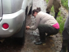
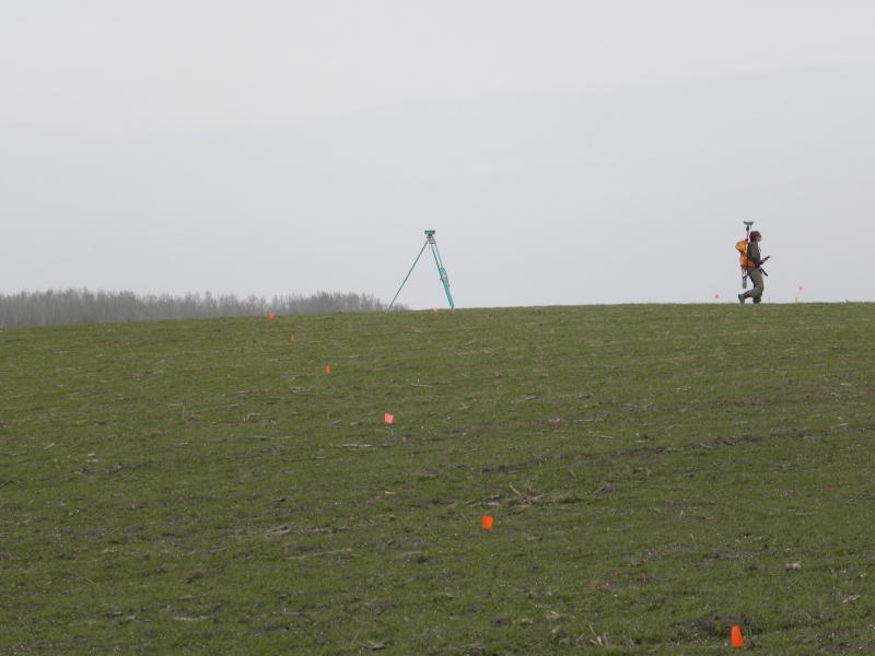
The new GPS unit has turned out to be an essential instrument, and there’s no way we would have gotten as much done as we have without it. Previously we had used a laser theodolite (or “Total Station” similar to those used to lay out roads and bridges) to lay in our grids and create topographic maps. Unlike those instruments, which operate using an optical laser and a prism, the new GPS has two receivers that communicate with satellites and with each other to establish their precise point on the earth. This means we can work much faster and get much more done.
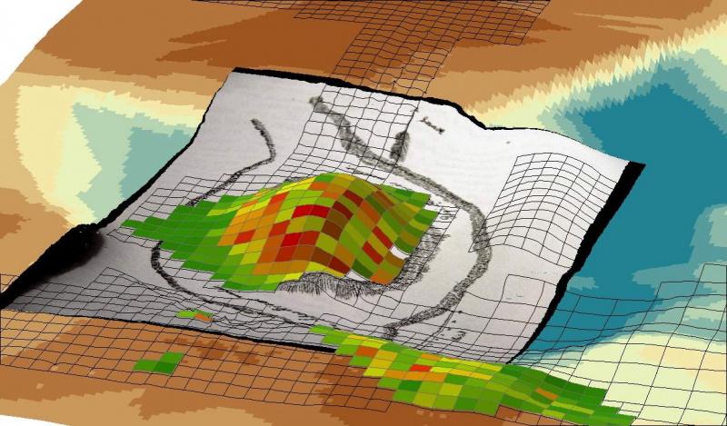
In addition to using the GPS to establish the grid over the site for controlled artifact collection, we also use it to create extremely detailed maps of the topography of the tell and the surrounding areas (see above photo.) We do this by strapping the GPS receiver onto a team member’s backpack, then we set it to collect a point automatically every time it moves a specific distance. This lets us collect data rapidly and allows us to create extremely precise topographic maps that are critical for understanding the location of sites on the landscape (see Photo #2 below.)
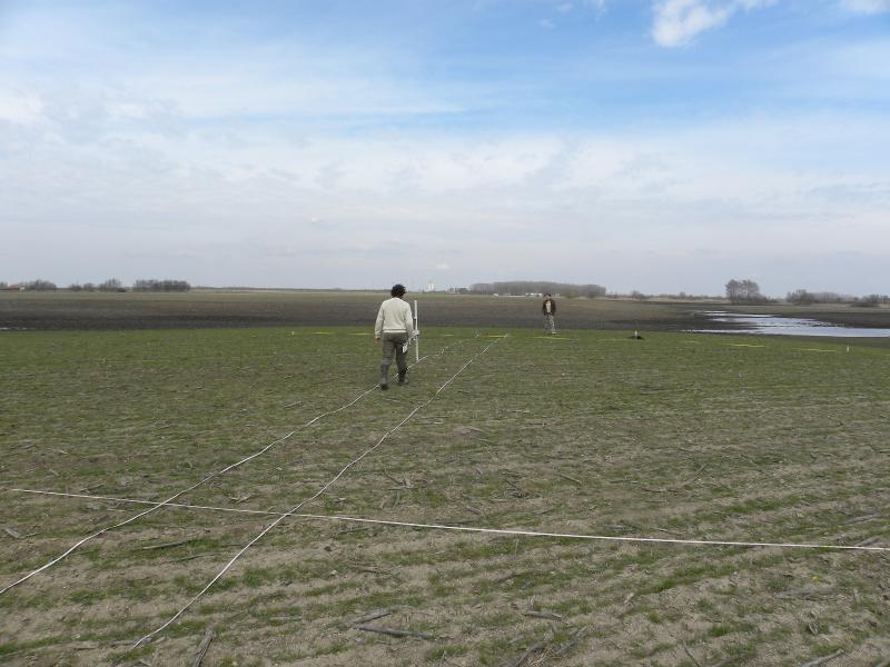
The Greek Geophysical team, led by Dr. Apostolos Sarris, arrived last Sunday and worked through yesterday (see Photo #3 below.) Astonishingly, in less than one week they managed to scan a staggering amount of ground (nearly 9 hectares!) using magnetometers, and their results are quite interesting.
In addition to identifying the edges of the tell site, they also worked in an area south of the tell site, where we'd identified a massive amount of ceramics, bone, stone artifacts, and daub (burned rubble from wattle-and-daub walls). The preliminary results of their magnetometry survey indicate the remains of several rectilinear features that are most likely longhouse foundation trenches, as well as many other features that are probably pits associated with a large settlement that was located to the south of the tell.
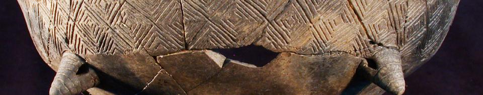
One of the most surprising discoveries of the season has been the identification of several dispersed daub concentrations on the surface, about 500 m from the tell. These features have massive amounts of daub, few ceramics, and some stone artifacts (mostly fragments of grinding stones).
When we sent the magnetometry team to investigate these surface features, they identified massive rectilinear features that appear to be longhouses. These kinds of houses were commonly used throughout the Carpathian Basin during the Middle and Late Neolithic (ca. 5,200-4,800), and like the large settlement south of the tell, they probably were contemporary with the occupation of the tell itself.
It’s now beginning to appear that the Szeghalom-Kovácshalom tell was not an isolated, fortified settlement like the Vésztő-Mágor tell, located just down the road. Instead, it appears that it was surrounded by streams that may have provided a natural defensive system. It also seems to be one relatively small piece of a complex puzzle that includes the tell itself, which was surrounded by a much larger settlement that extends several hundred meters away from the tell.
The complexity of the prehistoric settlement in this region continues to impress us, as it did our predecessor, Kálmán Darnay, over a century ago. Through our continued studies this season and in the future, we hope to build gradually upon his work to better understand what attracted people to come together and live so closely to one another here more than 7,000 years ago. In so doing, we hope to learn more about how early farming village societies evolved, and how they eventually gave rise to societies with more complex political and economic systems.
Thanks again for following along while we're in the field!
Bill
© Dr. Attila Gyucha
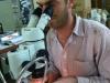
Analyzing Surface Artifacts
© W.A. Parkinson
Collecting GPS Coordinates
© W.A. Parkinson
Conducting a Magnetometry Survey
Recent Blog Posts
4. Winding Down
Thursday, April 11, 2013
These last couple weeks haven't been easy. We've made progress, but we've continued to be hammered...
3. Ez fáj! (This hurts!)
Thursday, March 28, 2013
We finally managed to get into the field last Thursday after the snows, rain, sleet, and hail. As...
2. Na! Haladjunk már! (Come on! Let's go already!)
Wednesday, March 20, 2013
Well, that was an interesting week! As I reported in my last dispatch, we were able to work from...