2. "Végre!" (Finally!)
Submitted by William Parkinson on Fri, 03/23/2012 - 00:00
© W.A. Parkinson
Documenting Stratigraphy
After two years of searching, we've finally found the trench from Kornél Bakay’s excavations on the Szeghalom-Kovácshalom tell! This trench, which was excavated in 1969, is key in helping us understand how the entire settlement grew from its founding in the Middle Neolithic period to its explosion of growth and massive size in the Late Neolithic. With this discovery, we can finally start adding a temporal dimension to our work, which until now has focused primarily on defining the horizontal organization of the site.
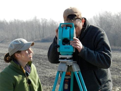
Over the last two years, we've employed several techniques in order to identify the old trench, which really was like finding a needle in a haystack. The tell is a very complex artifact that was created by people who lived on the site for almost a thousand years. Each time someone built a house, or burnt one down, or dug a storage pit, or built a new pottery kiln, those activities left behind traces that we can locate using different research techniques. But, as the tell grew up horizontally over time, generation after generation, these layers of cultural debris became superimposed over each other, creating a complicated storyline that’s difficult to understand without excavating. However, to excavate such a complicated site systematically would take decades!
In addition to the complexity of the site created by its long occupation, we’ve also had to wrestle with the impact of previous research conducted on the tell during the 20th century. Excavations at the site began in 1904, when Kálmán Darnay began a campaign aimed at exposing the stratigraphy—the layers of civilization that had built up over time—in the center of the tell. His research was followed up by Gyula Szeghalmi in 1912, and then again by Kornél Bakay in 1969, who each excavated units of 300-350 square meters (358.80-418.60 square yards) into the tell, reaffirming the stratigraphic sequence initially established by Darnay.
These previous campaigns at the tell provided us with glimpses into the stratigraphy of the site, and gave us a sense of how deep the debris of long-term occupation might be. However, these campaigns also modified the surface significantly through their excavation activities, making it difficult for us to identify the location of the old excavation units. To make things even more complicated, we needed to find one particular part of one specific trench that was excavated by Kornél Bakay in 1969, because it was the only area where he excavated all the way down to the sterile soil. As a result, it was the only place where we could examine a stratigraphic profile that spans the entire sequence of occupation at the site.
Our idea was to identify the 1969 excavation trench and dig out the fill from the old excavations so we could collect samples for radiocarbon dating and other techniques that would let us better understand—in very specific terms—exactly how and when the tell developed during the later Neolithic period. But our efforts were thwarted by the complexity of the tell. The previous excavations, and the fact that the tell has been plowed for millennia, complicated the results of our surface collections there.
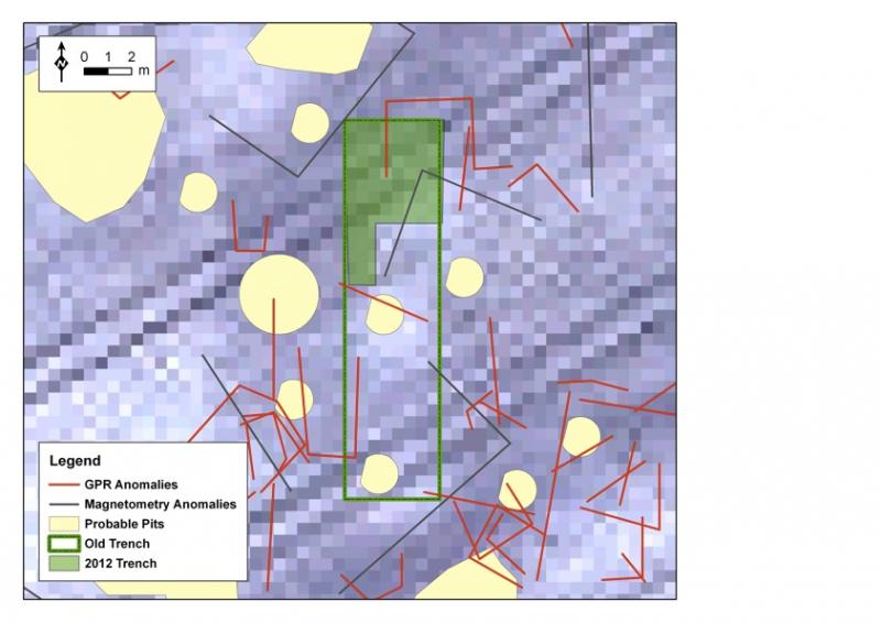
The nature of the cultural sediments also made it challenging to extract useful soil cores from the site. And the superimposed ancient features complicated the results of our geophysical prospection at the tell, which revealed an area densely packed with features…on top of features…on top of features. (We don’t have as much of an issue with this at the outlying parts of the settlement, which were occupied for shorter periods of time, and which did not build up superimposed layers.)
What finally sealed the deal for us were two critical pieces of information—one came from examining multi-spectral satellite data (see the maps below), which showed an anomaly about the right size of the Bakay trench (16x4 m or 52.49x13.12 ft), the other came from our Greek geophysical team, who found an anomaly with the ground penetrating radar that roughly corresponded to the northern portion of the satellite anomaly. We went “all in” on that one location and decided to expose a small surface in the plowzone of the tell—and if that didn’t work, we were going to have to rethink our approach to things.
We hit paydirt! We immediately identified two surfaces that we thought might correspond to the east and west edges of the Bakay excavation trench—they were almost exactly 4 m (13.12 ft) apart, running north-south. As we exposed a larger area, we found the northern edge of the old trench. We dug out the 1969 fill to about 4 m (13.12 ft) below the surface until we hit the base of the trench.
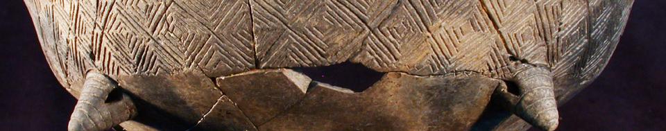
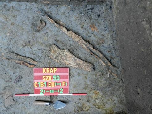
Then things got even more interesting! During his excavations, Bakay had noted wooden timbers at the base of the tell, which should be over 7,000 years old. We assumed he’d taken them out when he excavated. To our surprise, when we hit the bottom of the old trench, we identified a cultural layer below the corner that contained many artifacts and several pieces of very well preserved ancient wood that appears to have been modified—the same layer Bakay found 32 years ago! (See Photo #3 below.)
We now have several different operations running on the site simultaneously—the tell stratigraphy operation, the two excavations of the longhouses in the north and east (which I reported on last week), and the survey, which is now almost completely finished. We also opened up a small 3x2-m (9.84x6.5-ft) test unit in the settlement to the west of the tell to see whether houses in that portion of the settlement are different from those elsewhere.
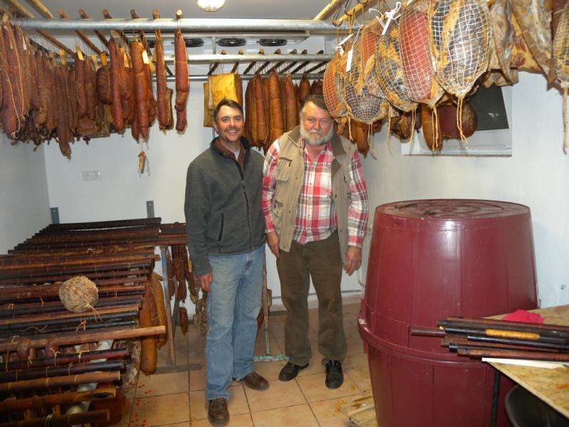
The weather has been wonderful to date, and things are going very well. We hope that the weather holds and we’ll continue to have as productive a season as we have so far. Tonight, the team and I will be preparing for a big feast over the weekend by helping a friend of mine make sausage—one of the delicious benefits of working in Hungary! (Take a look at Photo #4 below.) But more about that story next week....
Stay tuned!
Bill

Map © R. Seifried
Satellite View of Tell
Map © R. Seifried
The Bakay Trench
© W.A. Parkinson
7,000-year-old Wooden Fragments
© W.A. Parkinson
Sausage is King!
Recent Blog Posts
4. Winding Down
Thursday, April 11, 2013
These last couple weeks haven't been easy. We've made progress, but we've continued to be hammered...
3. Ez fáj! (This hurts!)
Thursday, March 28, 2013
We finally managed to get into the field last Thursday after the snows, rain, sleet, and hail. As...
2. Na! Haladjunk már! (Come on! Let's go already!)
Wednesday, March 20, 2013
Well, that was an interesting week! As I reported in my last dispatch, we were able to work from...