2011: Digging Begins

For the 2011 season, Dr. Parkinson and his team devised a multi-layered approach to clarify the relationship between the tell, longhouses, and surrounding settlements at Szeghalom-Kovácshalom:
Determining Site Scope
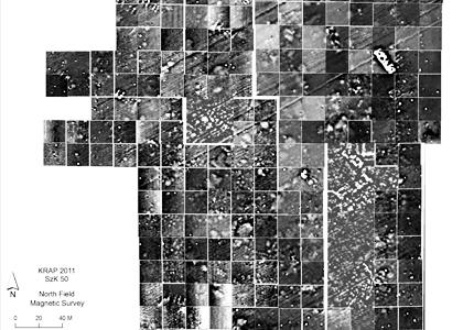
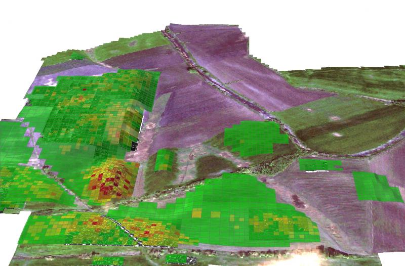
To widen their understanding of the site’s size and layout, the team scanned an additional 90,000 square meters (107,639 square yards) of Szeghalom-Kovácshalom using ground penetrating radar, magnetometers, and a handheld hyper-spectrometer—tools and techniques that help locate manmade structures hidden beneath the soil. The team also created detailed topographic maps of different archaeological and environmental features, such as longhouses and riverbeds.
Determining Site Use
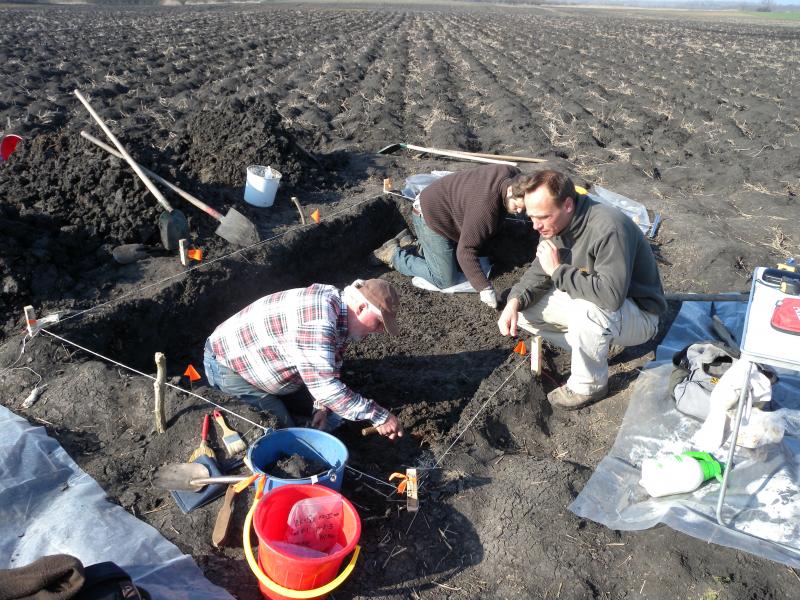
To understand how different parts of Szeghalom-Kovácshalom were used and when they were occupied, the team collected surface artifacts across the site—a total of 33 hectares (that’s about 70 football fields!) In addition, the team also took soil cores and soil chemistry samples and conducted test excavations in two structures: a longhouse from the East Field and a house from the South Field, where in just one small 3-x-2-m test unit alone, the team discovered two burials and several other features, including pits and wall fragments.
Preliminary Results
The results of these investigations both confirmed and challenged the team’s findings from the previous year. At the end of the 2010 season, it appeared that the site was sub-divided into three distinct and quite separate zones—the tell, the horizontal settlements, and the longhouses. But in 2011, the team discovered that, while these three different zones of use are visible across site, the lines between them are blurry, with one zone blending into the next.
Scanning results revealed many more longhouses, most of which surprisingly occurred in groupings rather than as isolated individual structures. In contrast to last year’s findings, artifact collections and soil cores also showed that horizontal human settlements crept closer to these longhouse groupings than anticipated—and in fact, a new area of occupation was discovered to the north of the tell!
The test excavations, artifact samples, and soil cores also reinforced the team’s impressions about how and when different parts of the site were used. For example, the rich, deep layers of cultural remains found in and around the South Field mark it as the most densely occupied portion of the site, used over the longest period of time. In contrast, the East Field longhouses were lightly occupied for only a short time, while the newly discovered northern settlement fell somewhere in the middle.
Dating the Site
Surprisingly, almost all of the dateable material collected at Szeghalom-Kovácshalom seems to come from the Late Neolithic period. This means that the site’s inhabitants congregated together fairly quickly and for a relatively brief period of time to form this tell-settlement-longhouse community. Radiocarbon dating of bones, charcoal, and plant remains will soon provide the team with a more precise timeline for the site’s development. And future soil studies will also help identify environmental factors that may have contributed to the community’s rapid rise and decline.